It's not just dirt.
Sedimentary sequences have a geologic history - a unique story of depositional environments through time - and the stratigraphy and subsurface relationships that result. It's geology that determines the geometry and geotechnical and hydrogeologic properties of the sediments.
For example, it's the geologic story that allows us to determine if buried sands occurring at similar elevation in drillholes are part of a continuous geologic unit or are instead, either separate beds in a sequence of dipping beds or even discontinuous lenses that just happen to occur at similar depths and elevations. Deciphering geologic processes is the key, the only answer, because geology is the Sole Independent Variable.
Every Site is a Learning Opportunity
![]()
Every project gives us a new chance to learn about geology. We can choose to collect geologic samples and work towards understanding the depositional environment/geologic history or we can settle for mapping secondary properties that are controlled by and dependent on the Sole Independent Variable. High Resolution Site Characterization tools provide priceless data when they are applied for their purpose, but their convenience tempts us to overuse them at more complex sites that deserve - and often demand - more than just measuring particular properties.
We squander the opportunity to learn when we choose to ignore geology or instead rely solely on mapping secondary attributes such as lithology (I.e. soil classification), geophysics, or a HRSC tool alone. Despite the merit of these tools, lithology-based measurements alone commonly fail to reveal depositional processes or geologic story, that is, the stratigraphic relationships of the sediments.
Opportunities to learn are priceless. Being able to decipher geology requires two things: (1) being capable and (2) being willing to do it. A basic background in Geology allows geo-professionals the insight for applying the fundamentals of sedimentology and stratigraphy to projects. And even when we are capable of it, but not willing to take the time to decipher a sedimentary sequence -but instead relying solely on only a contaminant-based or lithologic-based mapping tool alone - we waste the moment of learning, fail to gain that priceless experience, and risk not identifying depositional processes and effects of secondary weathering which control the hydrogeologic system.
Applying the Multiple Working Hypothesis
Recognizing depositional features and knowing how they apply to scale, distribution, heterogeneity or uniformity leads us to a multiple working hypothesis about subsurface relationships. Sometimes field analysis requires persistence and patience. But when we use the right strategies to set ourselves up for success, we can narrow down our hypotheses to the point where we're not guessing or even "interpreting", but deciphering with confidence, the geology, which is the Sole Independent Variable.
Benefits of Experience
Geologic field experience allows us to make more accurate decisions in the field. It allows us to be mindful of the certainty vs. uncertainty our data has, and how that affects achieving project objectives. Some benefits of experience are:
- Knowledge replaces guessing.
- Clarity replaces confusion.
- Awareness replaces ignorance.
- Confidence replaces insecurity.
Our academic background puts us in a position to understand Geologic Principles. But applying principles in the field is more complicated than a textbook, and it's experience that provides the path toward solving complex problems, and faster.
For example, understanding geologic principles allows us to test what we learned in school but, without actual experience performing field work, we lack the practice to unravel the spectrum of complex variabilities that actually occur in nature.
There's no substitute for practice. And having a mentor helps us reach higher skill levels faster because mentors help us understand what we encounter in the field and how to more efficiently find the solution.
This is where training plays a role in our professional development. Getting meaningful training launches a person who is both capable and willing. The outcome is a mastery of the basics which is necessary to become proficient at any skill.
Experience deciphering geology is priceless because is allows reliable soil boring logs to reveal subsurface relationships, formation heterogeneity or uniformity, and effects of secondary weathering leading to projects that achieve their objectives. And it all starts with identifying the Sole Independent Variable, the geology.
A Personal Example: Nebraska Soil Cores.
by Dan Kelleher, PG, CIPM
![]()
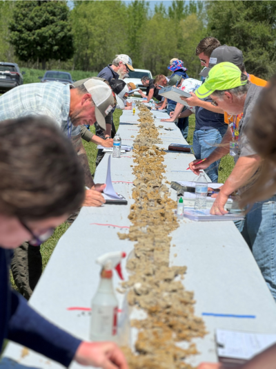
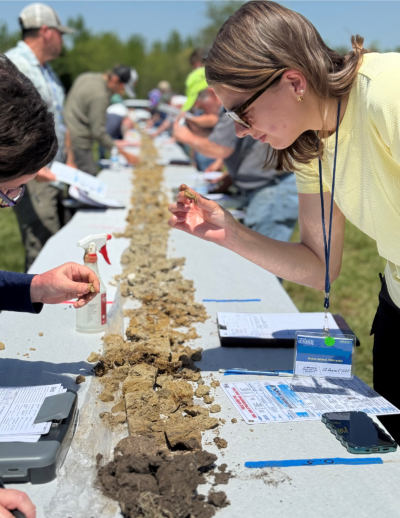
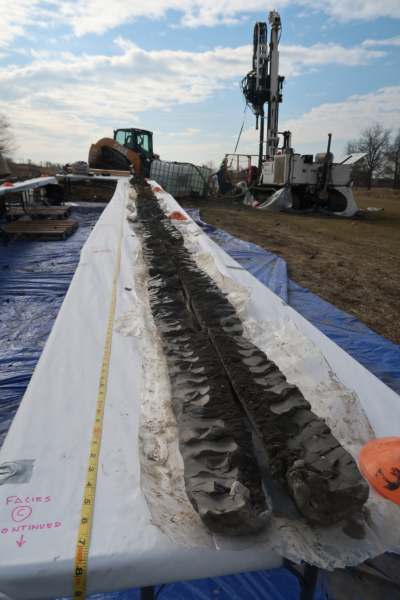
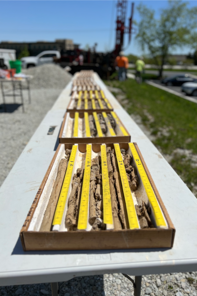
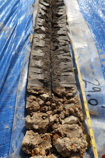
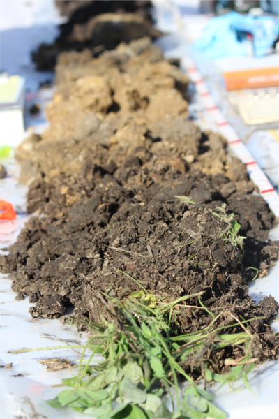
Last year, Midwest GeoSciences Group conducted a soils workshop in Nebraska with two borings: one boring was located in the drainageway valley and the second boring was drilled on the hilltop. It was a superb opportunity to see subsurface relationships between stratigraphy and landscape. Each boring was continuously sampled to bedrock and the cores were placed parallel on side-by-side tables from end-to-end to help read the story the sediments were telling.
The boring located on the hilltop exhibited a sequence of stacked glacial tills with extensive weathering to 80+ feet deep. Although the secondary weathering was relatively deeper compared to Wisconinan-age and some Illinoian-age successions, the composition of the glacial till and its altered nature was consistent with my experience and expectations.
However, the sedimentary sequence in the drainageway required deliberate and stepwise thinking about my observations in order to decipher depositional environment of the sediments. For example, the sediment did not have clasts floating in a matrix, so it wasn't a diamicton. It was nearly all black, but it was not uniform color. Faint-looking beds of variable thickness could be seen. Plus, the boring was drilled in a drainageway which probably gave the biggest "common sense" clue about depositional history.
The sedimentary sequence was a stacked stratigraphic sequence of alluvium. The lack of clasts gave a clue that the alluvium may be resedimented loess that washed into the drainageway. There was no apparent "pebble line" within the alluvial sequence indicating sorting or washing of resedimented diamicton so we came to conclusion that the sediment source of the alluvium was resedimented loess.
Observing, thinking and synthesizing was derived from personal experiences and our academic background. The class talked through a multiple working hypothesis leading to an answer that has been tested and confirmed to be the most likely conclusion. In the end there was the question about how the sequence fit into the regional stratigraphic nomenclature and that's where the local experts from Lincoln, Nebraska offered their priceless input.
-Dan Kelleher